
News Summary
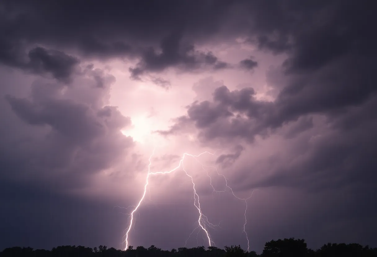
A severe thunderstorm watch is in effect until 8 p.m. on May 6, 2025, for much of Eastern Pennsylvania, affecting 26 counties including Philadelphia. Forecasters expect thunderstorms with damaging winds, heavy rain, and potential tornadoes between 2 p.m. and 9 p.m. The current weather conditions are unstable due to a stalled storm system. Residents are advised to stay alert for flash floods and severe weather updates as the situation evolves.
Philadelphia, PA
A severe thunderstorm watch is in effect across much of Eastern Pennsylvania until 8 p.m. on Tuesday, May 6, 2025. This watch covers twenty-six counties including Bucks, Berks, Chester, Delaware, Lehigh, Lancaster, Montgomery, Philadelphia, and Schuylkill, posing a potential risk of severe weather.
Forecasters indicate that the highest chance of thunderstorms will occur between 2 p.m. and 9 p.m. on Tuesday. The ongoing threat of severe weather is attributed to an “atmospheric traffic jam”, which is causing a slow-moving storm system to stall across the United States. This weather pattern has resulted in several days of clouds, rain, and thunderstorms for the Philadelphia area, with this Tuesday considered to have the highest severe weather threat of the week.
A tornado warning is currently in place for Northampton and Monroe counties as the weather conditions become increasingly unstable. The NBC10 First Alert Weather Team has issued alerts for the potential of damaging winds, heavy rain, hail, and the possibility of isolated tornadoes, continuing until the aforementioned deadline.
Weather Predictions and Risks
Heavy downdrafts, damaging winds, hail, and frequent lightning are all potential hazards associated with the severe thunderstorms expected today. The first severe thunderstorm warnings were enacted for parts of Berks and Chester counties prior to 2 p.m. on Tuesday.
Areas in Eastern Pennsylvania should expect scattered thunderstorms to develop by mid-afternoon, with some possibly turning severe. The main hazards from these storms include hail and the risk of an isolated tornado. Future predictions point towards storm activity migrating northeast into the Lehigh Valley and Northeast PA during the afternoon commute.
The severe weather threat extends beyond Pennsylvania, as parts of Delaware, Maryland, and Virginia are also at risk of severe storms. The expected storms will bring rains that may affect the broader Mid-Atlantic and Northeast regions.
Flash Flooding Concerns
Ongoing rain and increased risks of heavy downpours raise concerns regarding potential flash flooding, particularly in areas with poor drainage. Meteorologists are cautioning that unstable conditions caused by an upper-level low pressure system over the Eastern Great Lakes will further intensify the threat of severe thunderstorms in Eastern Pennsylvania.
An analysis of the weather indicates that while Philadelphia, parts of South Jersey, and northern Delaware face a lower Level 1 severe weather threat later on Tuesday, there is still a noted Level 2 risk in neighborhoods under the First Alert, signifying scattered severe storms with a potential for isolated intense systems.
Outlook for Wednesday
As the severe thunderstorm watch ends on Tuesday night, Wednesday may see continued wet conditions as showers are possible between 11 a.m. and 2 p.m. The forecast indicates that after the rain clears, it is expected to be partly sunny with high temperatures nearing 75°F.
In addition, thunderstorms are anticipated again on Thursday, after 5 p.m., which could lead to more severe weather impacting the region.
Residents are urged to remain vigilant and stay updated on the latest weather developments as conditions may change rapidly throughout the day. The potential for severe weather necessitates taking necessary precautions to ensure safety during this unpredictable weather event.
Deeper Dive: News & Info About This Topic
HERE Resources
Severe Weather Alert: Tornado Risks Extend Across Upper Midwest
Additional Resources
- Patch: Severe Thunderstorm Watch Issued
- Wikipedia: Severe Thunderstorm
- Fox Weather: Severe Weather Alerts
- Google Search: Thunderstorm Watch
- NBC Philadelphia: First Alert Storms
- Google Scholar: Severe Weather Events
- PA Weather Action: Large Hail Threat
- Encyclopedia Britannica: Thunderstorm
- The Morning Call: Storms with Hail and Winds
- Google News: Severe Weather Pennsylvania